The other weekend I was heading back to Portland from a trip down south. I took a new route in hopes of saving some time. As I was driving through the back roads of Tillamook, I saw a small state park sign advertising Munson Creek Falls. Seeing as how the weather was overcast and rainy, maybe I could snag a few forest shots in this obscure locale?
All posts by nick
There’s so much to be said for the Columbia River Gorge. And yet, I’ve seen so little of it. Thankfully, this time I was given a chance to follow a friend to one of his preferred hikes, the Eagle Creek Trail in Bonneville, Oregon.
Coming off my high from the swamp walk I had the week before at Sweetwater Strand. I decided I would do a mix hike/swamp walk and tackle the infamous Gator Hook Trail out on Loop Road. This roughly five mile trek can be either adventurous or very adventurous depending on how “deep” you want to get. I was all geared up for the long haul, so extra deep it is.
I’ve recently arrived to my new home in Portland, Oregon and the first free weekend I get I take my car to the coast in order to gaze across the mighty Pacific. However, things were not the same as they were in Portland. Instead of a blue horizon, I am greeted with a heavy fog. I thought all was awash (wish I had a better pun for this) until I drove a little ways north and past the rock formations near Crab Harbor.
After my tiny taste of swamp walking back in the Okaloacoochee Slough, I was itching to get some serious swamping in. Having passed by the location once before, I decided my first real swamp walk was to be held in the Sweetwater Strand off of Loop Road.
Previously on nickbotner.com, well not previously, but a few posts back I posted a black and white collection of photos from the back alleys of Naples Florida. This posting is from the same collection, however this time it’s in full color.
Early one morning, trying to figure out where I should go shooting, I decided I would head down to Marco Island and check out Tigertail Beach. Growing up as a kid on Marco Island, I spent a lot of time at Tigertail. And from what I remembered about the beach, it had some interesting shoreline and waterways. Perfect conditions for shorebirds and wading birds.
Early one Sunday morning I packed up the gear and set my sights on kayaking from Rookery Bay all the way up to Sand Hill Bay and back. With cameras in tow, here are the images I was able to capture.
More photos of shore and wading birds from the lovely Naples, Florida.
In the heart of the Everglades, off of State Road 29, there is an old dirt road called “Jane’s Memorial Scenic Drive”. Stretching 11 miles, this road runs through the Fakahatchee Strand State Preserve, and ends at the edge of the the Picayune Strand State Forest, the site of the now infamous “Swampland in Florida” scam.
Woke up early one Saturday morning and decided to pick a place on the map I have never been, load up some camera gear and go for a drive. I ended up in the Okaloacoochee Slough State Forest, on the Mustang Loop trail in Hendry County, Florida.
At the time of this post I live in Downtown Naples, FL. With all the redevelopment, it’s not very historic any more. However, there are still a few alleys headed down to the beach that hold a bit of history. Every now and then I take the time to walk down these alleys and enjoy the unseen quaintness they have to offer. This gallery is a collection of my favorite photos (converted to black and white) from these back alleys and associated side streets.
One of the kayaking gems of South West Florida, Estero River. Join me as I kayak all the way up the river and then head back out into the Gulf of Mexico and loop around Mound Key Archaeological State Park. Wow, that really sounded like I was introducing a TV spot. Ok, let’s get back to the Yakin!
When you visit Collier-Seminole State Park, there are three trails for you to choose from. Beginner, Intermediate, and Advanced. This trail, the 3.5 mile trail is the intermediate trail. It’s great to hike down, and even easier to bike through.
One morning I headed out to Keewaydin Island by Kayak. As I sat there on the kayak with the rising sun behind me I noticed how nicely it warmed up the breaking waves. So I spent a bit of time with the telephoto trying to capture the moment.
Round two for Kirby Storter. If you missed the first one, you can find it here.
Read More
Heading south on Tamiami Trail (41) just a few miles past Collier-Seminole State Park is a little access point called the Ten Thousand Islands National Wildlife Refuge. The trail has been there for a little while, however recently they have made it more accessible with a parking lot, new signs, and a small lookout tower. I took a quick stop one day to see what it was all about.
Volcano Pacaya lies 19 mi southwest of Guatemala City, which is about an hours bus ride from Antigua. The volcano sits inside the Pacaya National Park and touts an elevation of 8,373 feet.
So far, the last activity reported has been the eruption that peaked on May 27, 2010, causing ash to rain down in Guatemala City, Antigua and Escuintla. Since the last eruption, there have been visible lava flows where hikers can get close enough to cook a marshmallow.
Guatemala is know for its coffee. So when you are in Antigua, you best make it out to the Filadelfia Estate and check out their coffee plantation. Oh, and while you are there, hop on one of their tricked out Mercedes trucks and do some high adrenaline zip-lining between mountain peaks. You won’t be disappointed.
Antigua, Guatemala was founded by the Spanish back in the sixteenth century. For over two centuries it served as the capital city of Central America. With it’s European styled architecture, dating back over 300 years, it annually draws in thousands of visitors from around the world.
While I personally do not follow the Catholic faith, one cannot deny the beauty and passion that went into designing and constructing these amazing works of art.
I’ll be honest here, I don’t know anything about the people of Antigua. All I have is my week on the streets and my limited interaction with them. As far as I know, they are kindhearted and hard working people. I just wish I had a bit more time to actually get to know a few before I left.
In the streets of Antigua, walls are everywhere. With its narrow sidewalks and cobblestone streets, it almost feels like you are constantly walking down an alley in some kind of inverted cityscape. From the streets, almost everything is concealed from public view. However, if you pay close attention to the craftsmanship of a door or window, you can get a much better idea of what lays hidden on the other side.
Ahh the cobble stone streets of Antigua. Nothing says ankle sprain like walking your date to dinner six blocks across some of the most torrential cobble stones in Central America. Actually, I felt bad for any luxury automobile that had to make its way through this town. But this posting isn’t about the actual construction of the streets, but more so what you will find on them throughout the course of the day. This photo set is comprised of images I took while exploring and walking throughout the historic and beautiful Antigua.
This Spring (2011) we made our way down to Antigua Guatemala for a friends wedding. We spent about 5 days in the city of Antigua exploring all of its little nooks and crannies. During our visit we stayed at the El Convento Botique Hotel. It was definitely one of the most friendliest and accommodating hotels for foreigners I have been to. In between our moments of exploration and events, I managed to take a couple photos of this enchanting little hotel.
“The Holy week in Antigua Guatemala is famous for its Catholic celebration, which commemorates the Passion, Crucifixion and Resurrection of Jesus Christ. The entire city participates in the event, and receives thousands of national and international visitors.”
– aroundantigua.com
We just so happened to be in Antigua at the time of this event. The main roads were closed off so people could build/design their sawdust carpets. And people all over adorned purple cloaks and robes. After the event kicked off, it seemed every road you turned down, there was another procession. It almost made it difficult to make our way through the city at times.
Read More
For my birthday I wanted to hop in the yak and head down to Keewaydin for some early morning photography and beach combing.
Last fall I decided to pack up the kayak and spend a weekend camping in Myakka River State Park. I remember spending a few Easters up there with the family and figured I would see how things have changed in the past 20 years since I last visited.
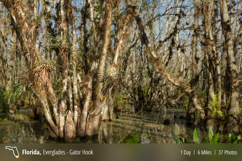
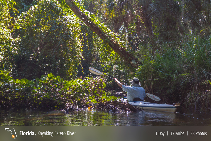
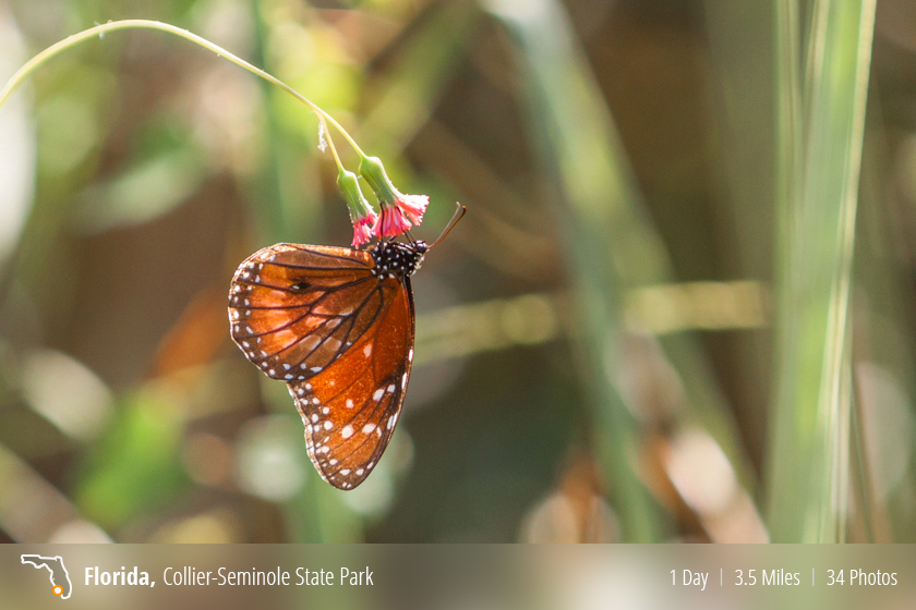
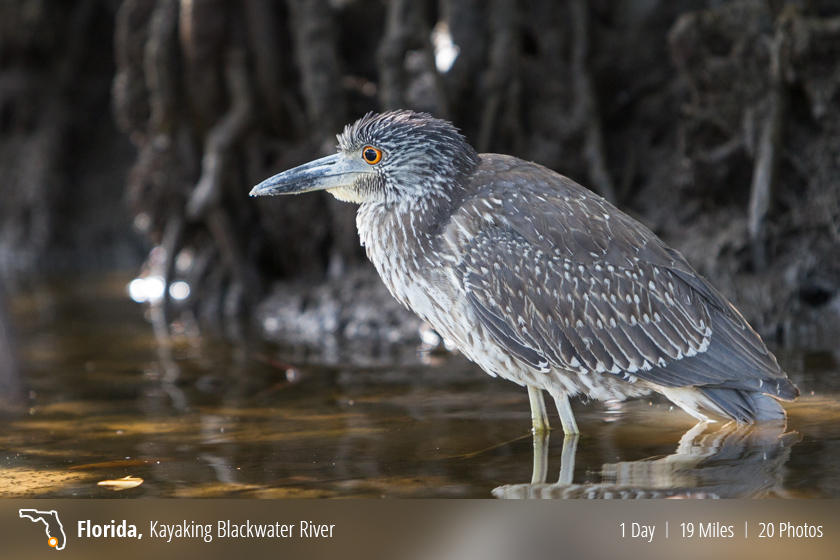
As a child, I remember my family taking me to Collier Seminole State Park on a few occasions. One visit my Father rented a canoe and we paddled down Blackwater River as far as Mud Bay before it was time to turn around. That was so long ago, so I don’t really remember much past that.
Here is what one of the park websites have to say about the State Park:
“The park overlaps the northern edge of the great mangrove swamp of southwestern Florida, and the southern edge of the Big Cypress Swamp. The park is the meeting place of the land and the sea, fresh water and salt water, and tropical and temperate zone vegetation. Because of this blending, a great diversity of plants and interesting wildlife are found here.”
– www.explorenaples.com
Having already documented the parks three walking trails, I figured it was about time to load up the yak and see how the ole canoe trail was holding up.
I launched my Kayak from beaches of Port Royal and headed south, once again, to the barrier island of Keewaydin.
Takachiho Gorge (高千穂峡)
Nestled in the center of the Kyushu mountains (northwestern part of the Miyazaki Prefecture) lies the Takachiho Gorge. “Takachiho” roughly translates to “thousand rice ears at the peak”.